Surveying the vegetation of Diego Garcia
In November 2018, funded by CCT's John Topp Botanical Fund, Sara Bárrios and Tim Wilkinson, a botanist and a spatial scientist from the Science Department of the Royal Botanic Gardens, Kew headed to the island of Diego Garcia with the aim of surveying the vegetation and making botanical collections.
Once known for its coconut plantations, the vegetation of Diego Garcia is now a complex mix of abandoned plantation sites gone wild, and areas where native plant species dominate. Prior to this field trip only very limited plant survey data was available for Diego Garcia. Using a suite of different survey techniques, both traditional and modern, the team planned to survey the whole island and its various habitats.
Collection and survey work
The expedition began with a more traditional survey approach, where we divided the island into areas and defined survey lines where vegetation was recorded every mile. These botanical data will be made available online via Kew’s UKOTs Online Herbarium.
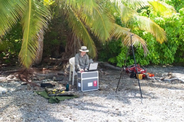
_Kew_copy.jpg) In addition to traditional recording of ground truth points with digital survey forms and 2D photos, we experimented capturing survey points with 360 photos. Annotated habitat images were recorded using a Ricoh Theta V 360 camera, which are available to view online. We have found this imagery to be particularly useful for habitat classification.
In addition to traditional recording of ground truth points with digital survey forms and 2D photos, we experimented capturing survey points with 360 photos. Annotated habitat images were recorded using a Ricoh Theta V 360 camera, which are available to view online. We have found this imagery to be particularly useful for habitat classification.
The plant survey dataset collected will now be used to guide and validate the mapping of Diego Garcia’s vegetation using very high-resolution satellite images. We also travelled with a drone with the aim of performing flights to survey a representative area of the island vegetation.
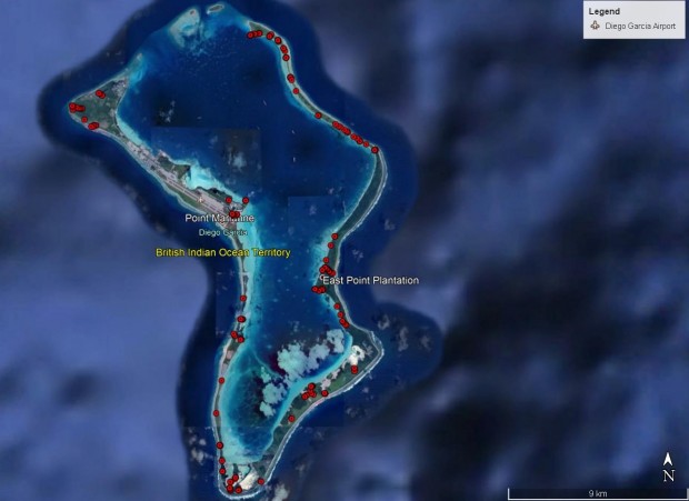
In total six flights were flown covering a portion of the eastern limb of the atoll from the reserve entrance up to Horsburgh Point, and an area around the East Point plantation settlement.
A camera mounted on the drone recorded images at a resolution of 10cm per pixel and in total a distance of 105km was covered. For each flight the set of images have yielded high quality image maps, orthomosaics, and complimentary photogrammetrically derived digital surface models (DSMs).
 The most significant problem we encountered was with finding appropriate take-off and landing sites as the high tides restricted the areas from which it was possible to launch and recover the drone, and hence the area of the reserve accessible for us to survey.
The orthomosaics and DSM’s generated from drone imagery can provide a baseline map from which to measure change and have significant potential to map, quantify, and monitor plant species of interest, namely the coconut palm (Cocos nucifera) and ironwood (Casurina equisetifola), as well as locate bird roosts and record turtle tracks.
To encourage recording of native and introduced species by Diego Garcia base personnel using the citizen science iNaturalist phone app, a dedicated iNaturalist page was set up and populated with some of our observations.
We also collected the first seeds from this overseas territory which have now been processed and accessioned at Kew’s Millennium Seed Bank and several fungi which have likewise been incorporated in the Fungarium at Kew.
Main botanical findings
The native flora of the Chagos Archipelago, which includes Diego Garcia, is considered to comprise 41 species of flowering plants and four species of fern, plus a wide variety of mosses, liverworts, fungi and cyanobacteria.
 No endemic species of plant have been identified yet, possibly due to the young age of this land mass. The flora is composed of pantropical widespread plant species which sustain all the other terrestrial island biodiversity.
On Diego Garcia, old plantation areas that are now abandoned show a very low diversity of plant species, forming what is known as “coconut chaos”. Natural light struggles to penetrate the ground and mosquitos and invasive rats are abundant.
In contrast, in areas where the native vegetation dominates the number of plant species is much higher, natural light is more abundant and native coconut crabs and seabirds thrive.
These areas, such as Barton Point, the most eastern point of the island, and small areas around Simpson Point on the western arm of the island, should be a priority for plant conservation on Diego Garcia.
Continuous monitoring of invasive species is heavily recommended, specifically the spreading of the following plant species: Tabebuia heterophylla, Bryophyllum pinnatum, Casuarina equisetifolia and Leucaena leucocephala.
Future work
In order to continue the work started during this expedition, future plant-driven expeditions should aim to complete ground truthing of the outer islands of the Chagos Archipelago to validate the vegetation maps; map the full distribution of native and introduced plant species; develop a National Red List for the native plant species of the archipelago, and establish a management strategy for introduced plant species.
Our work on the atoll will help to inform on the wider conservation management aims for the Chagos Archipelago, which look to foster the native vegetation to the benefit of the wider ecosystem.
All images (c) RBG Kew