BIOT Science Expedition 2014 - Prof Charles Sheppard’s initial report
Assessment of Coral Cover
Prof Charles Sheppard and Anne Sheppard, Warwick University (with support from David Curnick, ZSL/UCL)
We collected the first coral cover data from the Chagos Archipelago in 1978 and then again in 1996. After the Indian Ocean warming event in 1998, we have regularly monitored the coral cover in the same locations in Chagos (2006, 2010, 2012 and 2014) to determine how well Chagos' reefs have recovered from the 1998 trauma, especially in comparison to other Indian Ocean sites.
During this expedition we surveyed 25 sites at depths of 25, 20, 15, 10 and 5 metres and collected coral cover data from 718 quadrats, covering 180 square metres of reef in both lagoon and seaward locations. Quadrats were collected at all five islanded atolls, from ocean facing slopes facing the strong southeast tradewinds to more sheltered western and northwestern ocean slopes, and from several lagoon areas of varying degrees of shelter. Many of the reefs were sampled where temperature loggers were also deployed.
In each quadrat, data were collected, where relevant, on the number of coral colonies, number of coral interactions, dominant coral species, % coral cover, % soft coral cover, % algae, % sand, % sponge, % crustose coralline algae (CCA), % bare space and % dead coral. An estimation of overall cover at each depth was made in case the quadrats selected were not representative of the overall area.
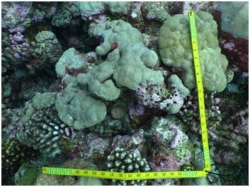
Figure 6: A simple folding metre stick used as an effective quadrat
These data will be analysed and the results compared with the data collected for the preceding 35 years, to determine trends.
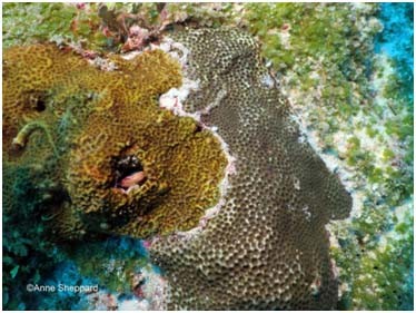
Figure 7: In an example quadrat, showing 2 coral colonies, 1 coral interaction, 60% live coral, 30% algae,5% CCA and 5% sand.
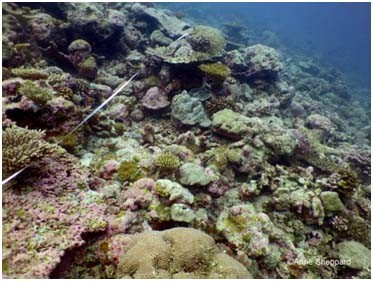
Figure 8: According to circumstances sometimes the quadrats were laid along a transect tape and other times they were laid randomly.