New satellite vegetation maps available
As part of CCT's Darwin Initiative's Darwin Plus project RBG Kew's GIS team have produced a set of vegetation maps using satellite imagery, expert input and available plant location data to provide a baseline for future conservation actions, particularly the terrestrial rehabilitation of the Chagos Archipelago.
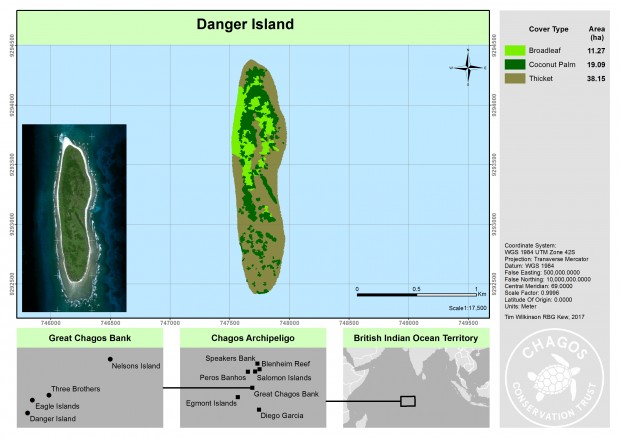
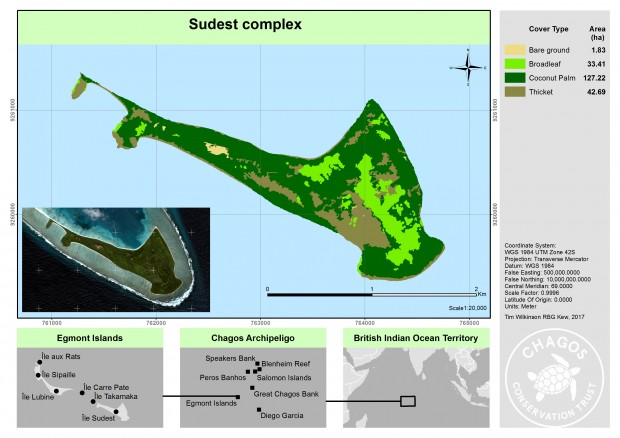
The new maps can be found on the Chagos Information Portal, a reference library of a science, research and conservation work conducted in the Chagos Archipelago.